
Weather Briefing — Atco, NJ 08004
- Updated: Friday, October 9, 2026 6:00 PM Eastern
- Next update: Friday, October 9, 2026 7:00 PM Eastern
- Generated: 2026-10-09T22:05:05+00:00
- Type: weather
Headline
A quiet, dry, and mild evening is underway across Atco under high pressure, but a significant pattern change is on deck: the remnants of Hurricane Isaias will sweep into South Jersey Sunday into Sunday night with widespread moderate rain (1–2", locally up to 3"), gusty east-southeast winds to 30 mph, a low-end tornado threat, and possible minor coastal tidal flooding — before drier, milder weather returns Monday afternoon and Tuesday.
Forecast Area
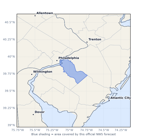
The official NWS forecast for Atco is issued by the Mount Holly (KPHI) office for forecast zone NJZ018 (Camden), which covers Camden County and vicinity in southern New Jersey. The map below shows the area where this official zone forecast text is valid.
Active Alerts
No active alerts for Atco or Camden County at this time. Note that the NWS Mount Holly office has issued a Gale Watch for the adjacent marine zones (offshore New Jersey/Delaware Bay waters) from Sunday morning through Sunday evening — this does not include the Atco land area, but it signals the strength of the wind field accompanying Isaias's remnants on Sunday.
Current Weather
It is a tranquil, dry autumn evening in Atco. The nearest official observation comes from Mount Holly, South Jersey Regional Airport (KVAY), about 12.1 miles from Atco, observed at 21:35 UTC (5:35 PM EDT) Friday, October 9, 2026:
- Temperature: 70°F (21.0°C)
- Dewpoint: 43°F (6.0°C) — a very dry 27°F spread, relative humidity just 38%
- Wind: West at 3 mph (280°)
- Pressure: 30.16 inHg (1021.3 mb)
- Visibility: 10 miles
- Sky: Clear (CLR at 12,500 ft)
- Present weather: None reported
MRMS radar-precipitation analysis (21:58 UTC) confirms no precipitation at Atco or anywhere within a 30 km radius — 0% coverage, zero echo coverage, and no surface precipitation detected within the wider 100 km search. The deterministic diagnosis agrees: no precipitation, no convective activity, high confidence (0.89).
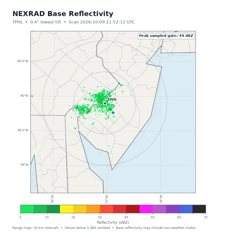
NEXRAD Level II data from the TPHL (Philadelphia-area) radar, 20.3 km away, scanned at 21:52 UTC at the 0.4° tilt (mean beam height ~191 m MSL over Atco). The analysis of 63,021 radar gates found a maximum reflectivity of 44 dBZ — but this is an isolated, non-precipitating signal (mean reflectivity is deeply negative at −8 dBZ, 90th percentile just 1.6 dBZ, and zero gates at or above 50 dBZ). This is consistent with ground clutter or biological returns rather than organized precipitation; no dual-pol moments were available for further characterization. No hail-like signatures.
GOES-19 GLM lightning data over the past 10 minutes (21:51–22:01 UTC) show zero flashes within 50 km — no electrically active storms anywhere near Atco, and the trend is steady.
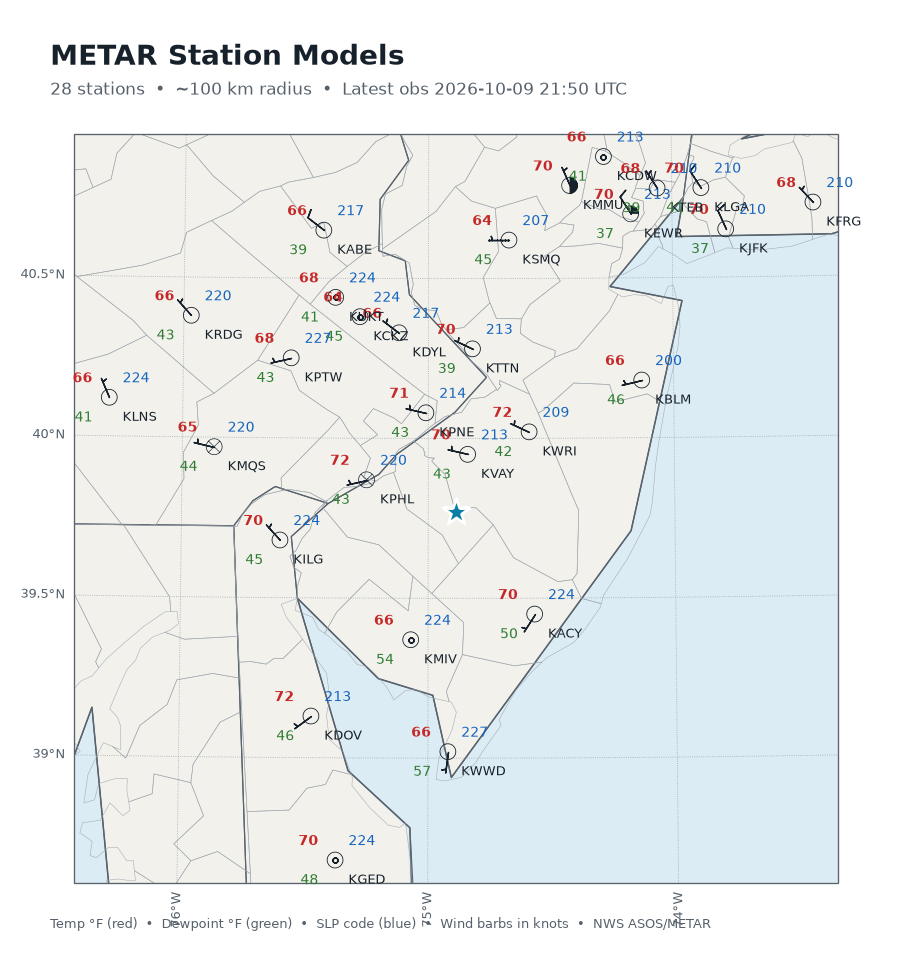
The regional METAR station-model map shows a uniform, dry, mild air mass across the Delaware Valley: temperatures in the mid-60s to low 70s (KPHL 72°F, KWRI 72°F, KVAY 70°F, KACY 70°F), dewpoints mostly in the upper 30s to mid-50s, light winds, and sea-level pressures tightly clustered around 1020–1023 mb — classic high-pressure dominance. Coastal-adjacent stations (KACY, KMIV, KWW D) run slightly more humid, hinting at the onshore moisture beginning to build ahead of Sunday's system.
Current Synoptic Setup
Per the NWS Mount Holly Area Forecast Discussion (issued 2:36 PM EDT Friday), a surface high pressure center is parked over the region through tonight, producing the tranquil, dry conditions and light west-northwest winds observed now. Cirrus cloud shield associated with the outflow from Hurricane Isaias is spreading across southern portions of the region and slowly lifting northward — expect increasing high clouds tonight even as winds diminish and temperatures fall quickly under any clear slots.
The bigger picture: Isaias is making landfall this evening in the western Florida panhandle and interacting with an upper trough. It will undergo extratropical transition, lift north into the Tennessee Valley through Saturday night, then turn northeastward toward our area on Sunday. The HRRR analysis at Atco confirms the current pre-storm environment: a deep, dry westerly flow aloft (winds veering from 277° at 925 mb to 274° at 500 mb, backing to 244° at 250 mb), a very dry mid-level column (RH dropping to under 10% between 725–600 mb), and a strong upper jet — 115 kt at 250 mb — signaling the approaching trough that will eventually capture the remnant tropical cyclone. PWATs modeled at 1.5–2+ inches for Sunday confirm a deep tropical moisture connection will be established as the system approaches.
GFS Guidance
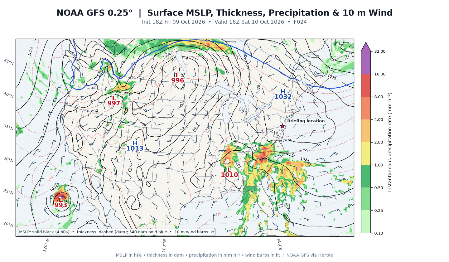
The GFS guidance below is from the 2026-10-09 18:00 UTC cycle (the newest cycle containing all requested leads), with point diagnostics for Atco.
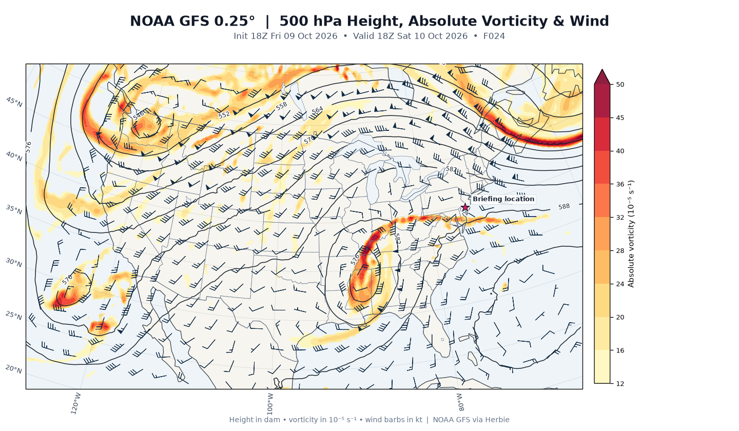
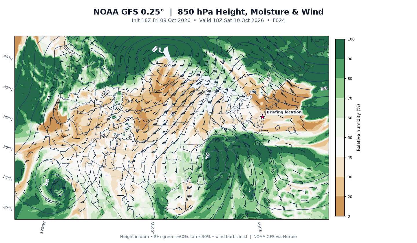
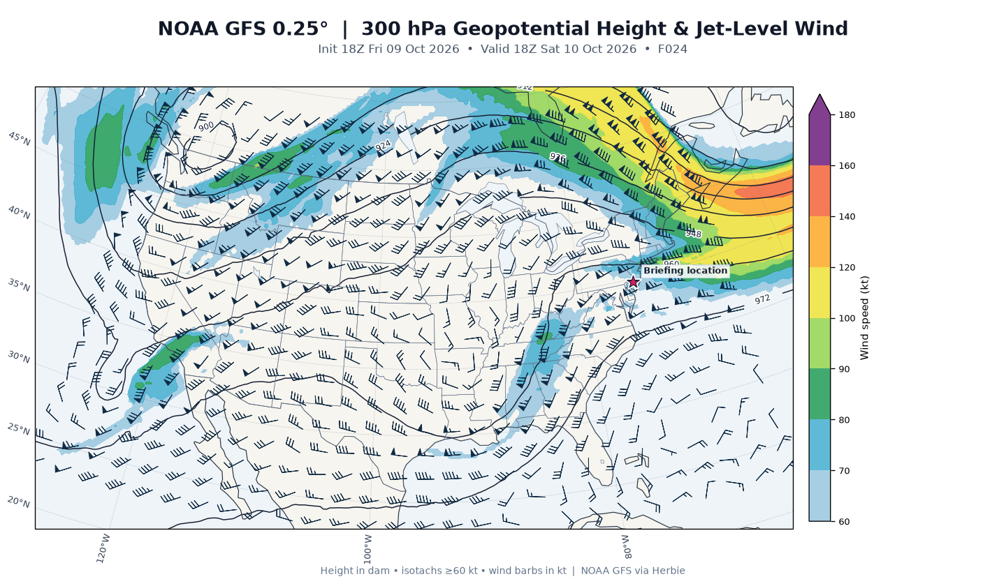
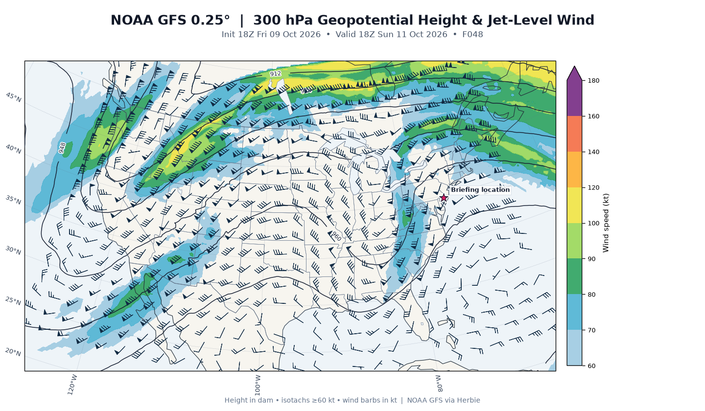
Day 1 — Saturday (F24, valid 18Z Sat Oct 10): Surface high pressure (1030.1 mb at Atco) dominates the region. Point guidance: 2-m temperature 21.6°C (71°F), dewpoint 5.5°C (42°F), light 5-kt winds, zero precipitation. The 500-mb chart shows broad ridging with modest height falls (586.9 dam) beginning to edge in from the west; 850-mb flow is nearly calm (1.8 kt) with very dry air (RH 31.7%). The 300-mb jet is robust at 64.5 kt — the leading edge of the trough approaching from the west.
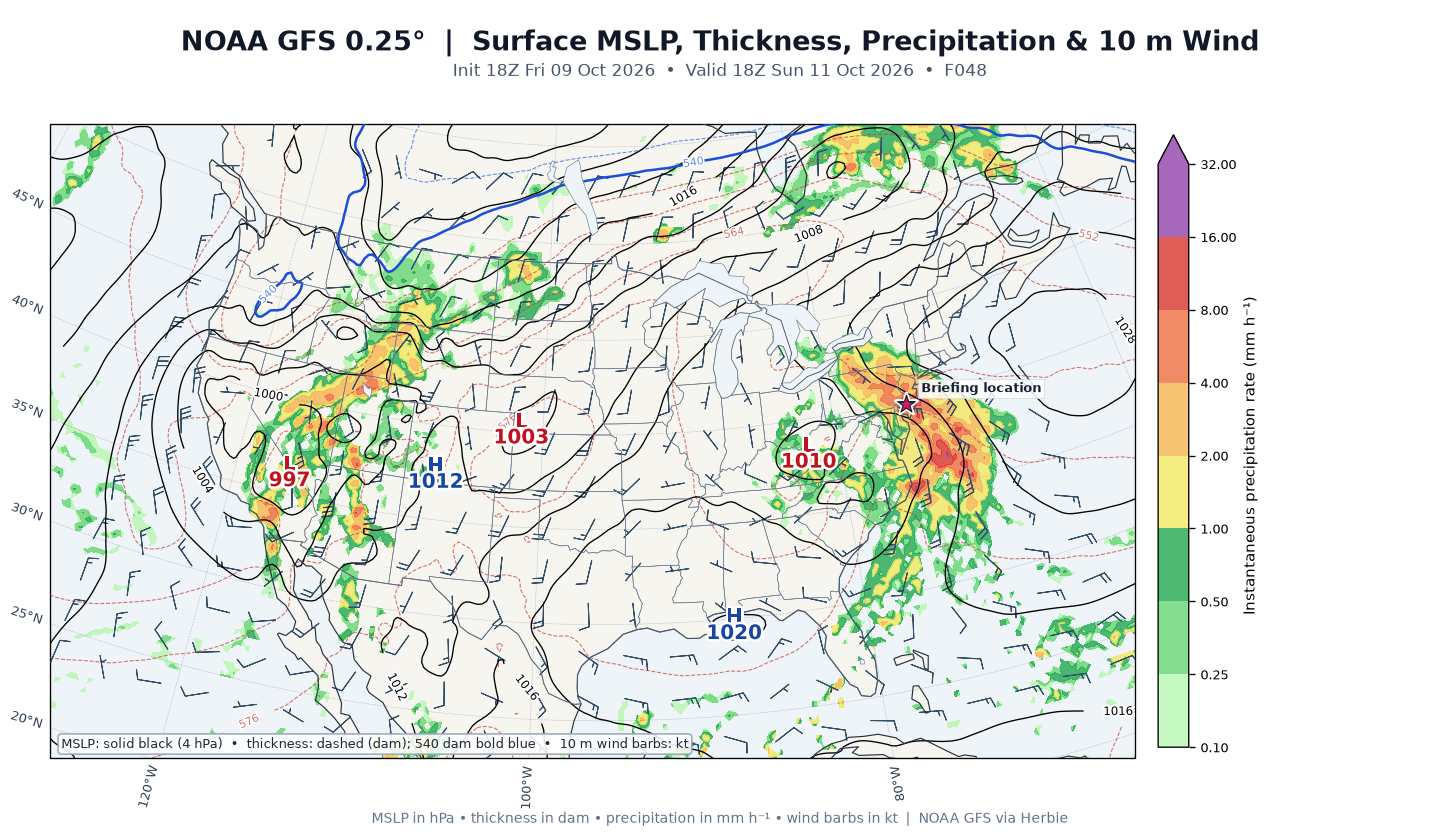
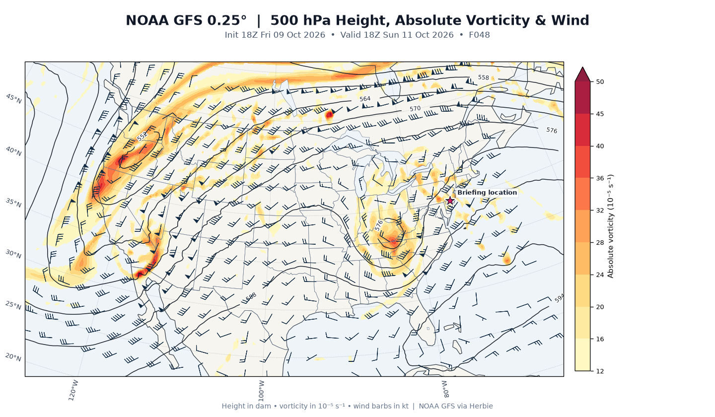
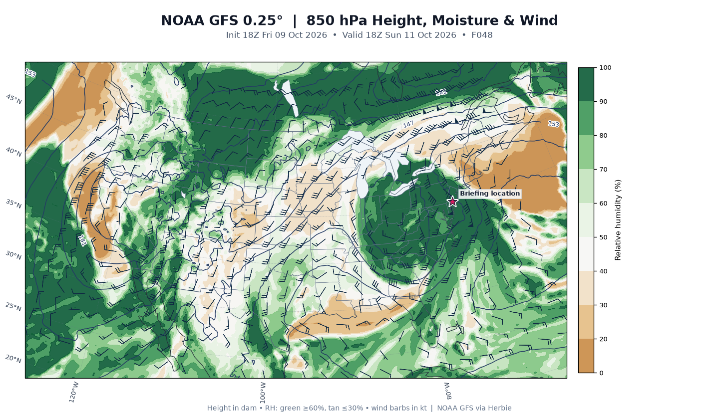
Day 2 — Sunday (F48, valid 18Z Sun Oct 11): The pattern flips dramatically. Surface pressure falls to 1017.8 mb as Isaias's remnants approach; GFS shows 7.5 mm/hr precipitation at Atco at this hour, 850-mb RH saturated at 100% with a strong 44-kt low-level jet — the tropical moisture conveyor feeding the rain shield. The 500-mb chart shows the remnant cyclone's vorticity signature (negative absolute vorticity anomaly of −9.9×10⁻⁵ s⁻¹ at the point) lifting over the Mid-Atlantic, with 500-mb heights down to 584.2 dam and winds increasing to 31 kt. Temperature 17.4°C (63°F) with dewpoint 16.9°C (62°F) — a nearly saturated, warm, wet column.
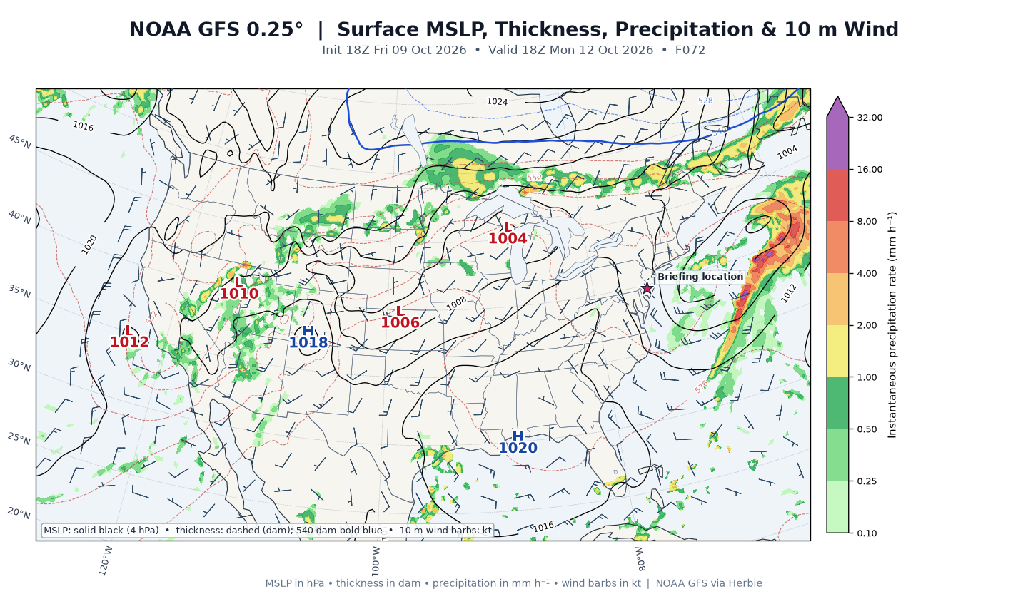
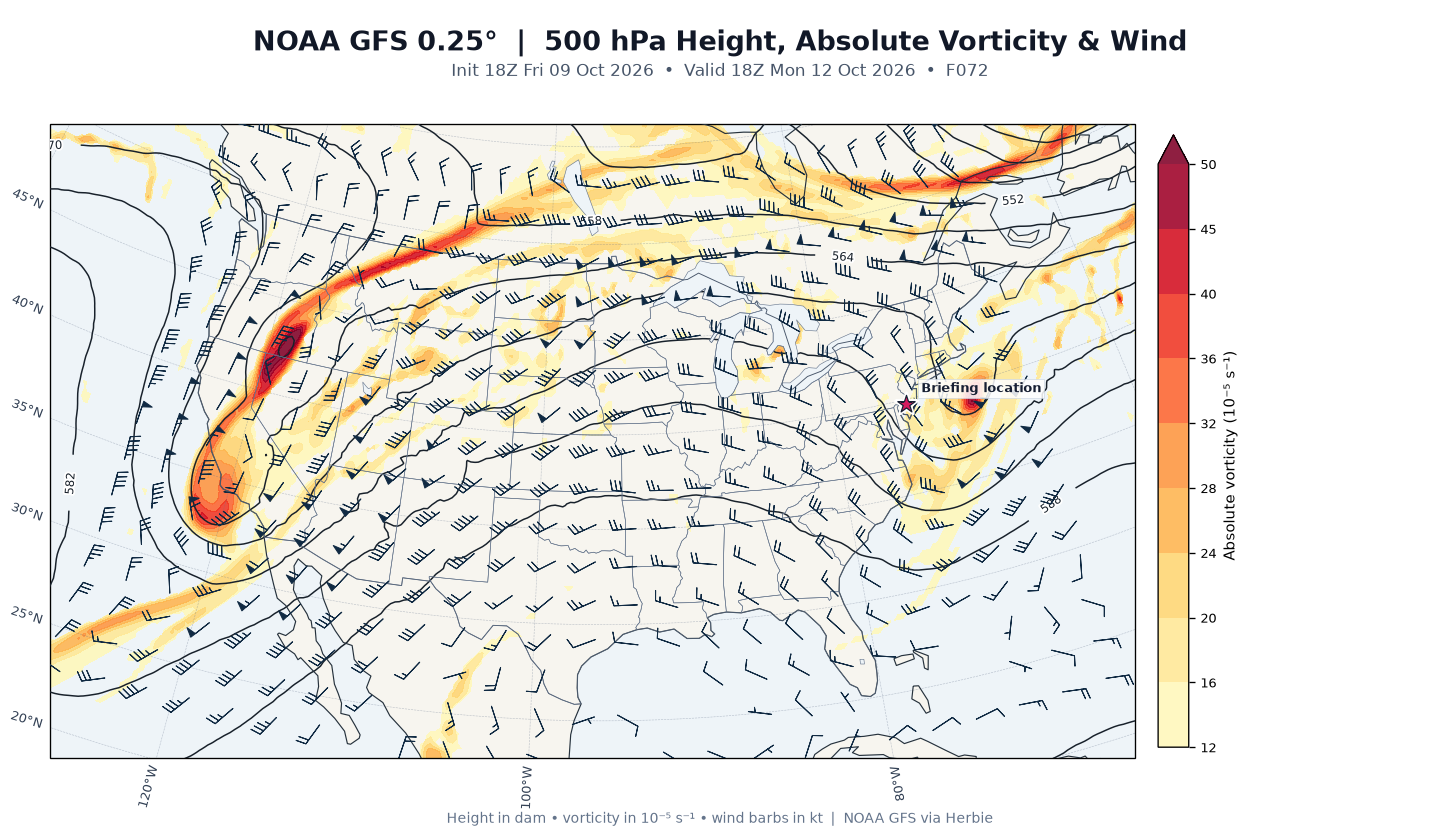
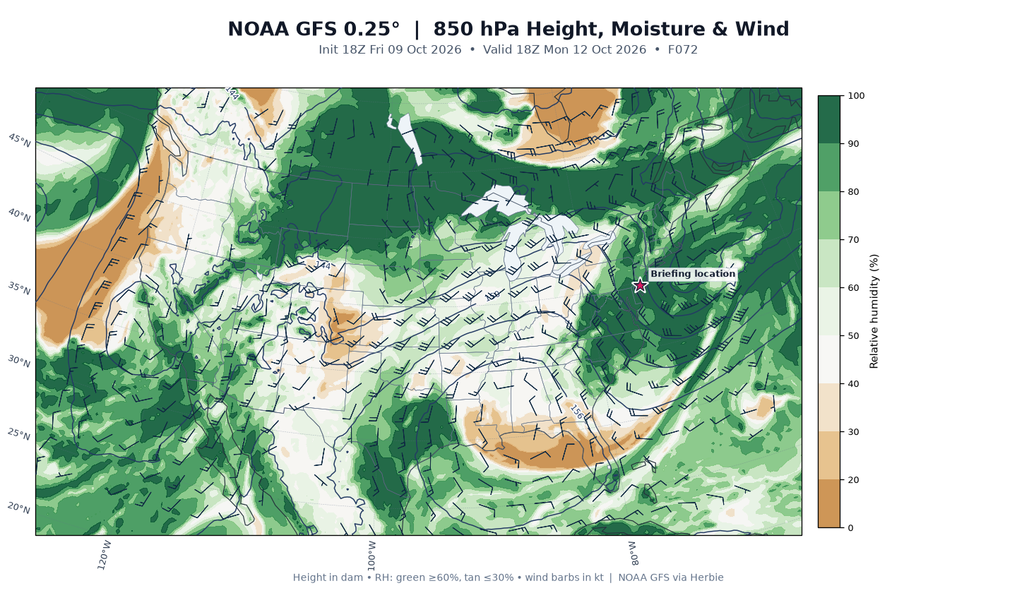
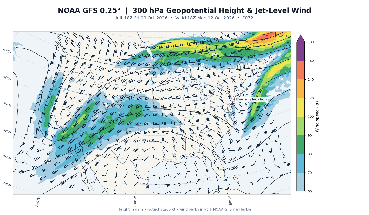
Day 3 — Monday/Columbus Day (F72, valid 18Z Mon Oct 12): The remnant low pulls away northeast; surface pressure bottoms near 1009.7 mb as the trough axis passes. Precipitation has ended at the point (0.0 mm/hr), though 850-mb RH remains high (94%) with lingering 19-kt flow — consistent with lingering showers/drizzle early. 500-mb heights drop further to 573.9 dam with positive vorticity advection (11.6×10⁻⁵ s⁻¹) overhead — a cold-core upper low signature — while 2-m temperature is 16.7°C (62°F) with dewpoint 14.5°C (58°F). The 300-mb jet remains strong at 59.5 kt.
HRRR Analysis
The following is HRRR model guidance from the 21:00 UTC October 9, 2026 cycle (forecast hour 0, valid 21:00 UTC), analyzed at the HRRR grid point 0.36 km from Atco — not an observed balloon sounding.
Surface thermodynamics: Temperature 21.4°C (70.5°F), dewpoint 7.2°C (45°F), surface pressure 1015.8 mb — matching the KVAY observation closely and confirming the dry, mild air mass. Dewpoint depression of 14.2°C indicates a very dry boundary layer.
Precipitation-type guidance: Categorical output is "none" — no rain, snow, freezing rain, or ice pellets. The freezing level sits at 3,923 m MSL (~12,900 ft), with the entire profile well above freezing below that; no warm-nose or subfreezing-surface complications exist. Any precipitation in the coming days will be all-liquid rain.
Instability: Surface-based CAPE is 0 J/kg with 0 J/kg CIN — a completely stable profile right now, consistent with high pressure. Mixed-layer and most-unstable CAPE are also zero. DCAPE of 595 J/kg reflects the dry air aloft (downdraft potential if showers intrude Sunday, but no current convection).
Moisture: Precipitable water is only 11.7 mm (0.46 in) — a dry airmass that will be completely replaced by the 1.5–2+ inch PWAT tropical plume on Sunday.
Lapse rates: 5.8°C/km surface-to-3 km and 5.9°C/km in the 700–500 mb layer — near-neutral, neither steep nor stable, typical of a dry high-pressure column.
Wind shear: This is the standout feature. The 0–1 km bulk shear is a modest 7 kt, but 0–3 km shear is 33 kt and 0–6 km shear is a very strong 51 kt, all westerly — deep-layer shear already in place ahead of the approaching trough. Combined with the modest instability Isaias's remnants may import Sunday evening, this shear is why the forecast office mentions a low tornado threat. The LCL is high (1,782 m AGL), and there is no LFC or EL — no parcel can rise freely in the current profile.
Indices: K index of −14.9 and Total Totals of 27.2 both confirm a convectively barren environment this evening.
Outlook
The NWS Mount Holly discussion frames the next three days around three key messages:
-
Tranquil and dry through Saturday. High pressure holds through tonight and shifts slowly east Saturday. Winds diminish tonight, allowing quick radiational cooling where skies stay clear; lows in the mid-to-upper 40s for most of NJ. Saturday stays dry but clouds steadily increase as Isaias's outflow cirrus lifts north; highs a couple degrees cooler than today, in the low 70s, with winds settling out of the east-northeast as onshore flow develops and cools coastal areas.
-
Isaias's remnants Sunday into Sunday night — the main event. Guidance has come into good consensus on the remnant cyclone impacting the region beginning Sunday and lingering into early Monday. Widespread moderate to locally heavy rainfall is the primary impact, with PWATs of 1.5–2+ inches; rain will be mainly stratiform but with convectively enhanced heavy bursts possible late Sunday day and evening. Expect a widespread 1–2" rainfall, isolated 3", heaviest toward the NJ coast and Delmarva (axis could shift). WPC has the region in a Marginal (1/4) Excessive Rainfall Risk — localized minor urban/poor-drainage flooding and road ponding possible; no river gauges currently forecast to reach flood stage, though a northward shift of the heavy-rain axis could push Raritan-basin gauges (Millstone River) toward minor flood stage. Winds increase to ESE 10–20 mph with gusts to 30 mph (40 mph immediate coast); temperatures hold steady in the upper 50s–60s. Shear and CAPE may reach values just high enough for isolated severe storms Sunday evening into Sunday night — southern zones are in a Marginal (1/5) Severe Thunderstorm Outlook mainly for a brief, weak tornado or damaging gust; rumbles of thunder possible by Sunday evening.
-
Minor tidal flooding Sunday morning's high tide, mainly Delaware Bay coastal communities (Bowers Beach, possibly Reedy Point), aided by new-moon tides and E/SE flow. Nothing like the late-September event; no tidal flooding forecast for the Atlantic coast north of Cape May County or on the tidal Delaware.
Confidence: High for the dry Friday–Saturday period and for the overall Sunday wet-and-breezy pattern (guidance consensus is strong); moderate on exact rainfall axis placement and on whether any Sunday-evening storm reaches severe levels. Aviation: VFR through Saturday, then restrictions in rain and low clouds Sunday–Monday with gusty ESE winds.
Forecast for Next 3 Days
Tonight (Friday night, Oct 9 – Sat 6 AM)
Mostly cloudy with Isaias's outflow cirrus overhead. Low around 48°F. Northwest wind 0–5 mph, diminishing to calm. Hourly guidance shows temperatures falling steadily from 68°F at 6 PM to 48°F by 6 AM, with RH climbing from 45% to near 90% by dawn. Precipitation chance: 0%. No hazards.
Day 1 — Saturday (Oct 10)
Partly sunny, high near 72°F. Light northeast wind 0–5 mph as the high shifts east and onshore flow begins. Morning starts cold (48°F at 7 AM), warming through the 50s and 60s to a mid-afternoon peak of 72°F around 3 PM; RH drops to the upper 30s. Cloud cover increases through the day — mostly sunny morning, partly sunny afternoon, turning mostly cloudy by evening. Precipitation chance: 0–1%. Saturday night: mostly cloudy, low around 55°F, east wind ~5 mph, dewpoints climbing into the mid-50s (RH reaching 100% by 11 PM) as the tropical moisture surge arrives. Trace rainfall amounts (<0.1") possible late.
Day 2 — Sunday (Oct 11) — the main weather event
Rain, high near 66°F. East wind 5–15 mph, gusts to 30 mph. Precipitation chance: 100%. Rain arrives in earnest mid-morning: hourly guidance shows PoP climbing from 16% at 6 AM to 45% at 7 AM, 73% ("rain likely") 8 AM–1 PM, and 100% rain from 2 PM through the evening. Temperatures are flat and damp — holding in the low-to-mid 60s all day with RH pinned at 97–100% and dewpoints rising to the mid-60s. New rainfall: 0.75–1.00 inch possible during the day. Sunday night: rain before 8 PM, then rain with a slight chance of thunderstorms 8 PM–2 AM (the window for the isolated severe/tornado threat), then a chance of showers. Low around 63°F, southeast wind 0–15 mph gusting to 30 mph. Additional 0.75–1.00 inch possible overnight. Watch for ponding on roads and minor poor-drainage flooding; a brief, weak tornado or damaging gust cannot be ruled out Sunday evening.
Day 3 — Columbus Day / Monday (Oct 12)
Chance of rain showers before 2 PM, then mostly cloudy, high near 71°F. Northwest wind 5–10 mph. Precipitation chance: ~40–44% early, dropping to 2% by mid-afternoon. Lingering showers and drizzle exit through the morning (PoP 44% at 7 AM, 18% by 8–9 AM, done by 2 PM), with temperatures recovering from 64°F at dawn to 71°F by 4 PM as drier NW flow arrives behind the system. Additional rainfall under 0.1". Monday night: partly cloudy, low around 58°F, light NW wind. Beyond: Tuesday looks mostly sunny and pleasant with a high near 75°F (only an 11% shower chance) — the best day of the stretch.
Bottom Line
Enjoy the calm: Atco is dry, mild (70°F), and quiet this evening under 1021 mb high pressure, with no precipitation on radar, no lightning, and zero instability — and Saturday stays dry and partly sunny with a high near 72°F. The story changes Sunday, when the remnants of Hurricane Isaias bring a soaking, breezy day: 100% chance of rain with 1.5–2 inches total (locally up to 3"), east winds gusting to 30 mph, a low-end threat of a brief tornado or damaging gust Sunday evening, and possible minor poor-drainage flooding — plan outdoor activities for Saturday, not Sunday. Rain lingers into Monday morning before clearing; Columbus Day afternoon and Tuesday turn progressively drier and milder, with Tuesday the pick of the week near 75°F. No watches or warnings are in effect for the Atco area right now, but monitor updates as the Gale Watch offshore and the Marginal severe/excessive-rain risks for Sunday are refined in coming cycles.